The wastewater industry is constantly evolving. New developments in technology show us faster and more accurate ways to complete maintenance work—and often with fewer resources. Through these advancements, we get a glimpse into what’s possible in the industry and what more can be learned from our systems underground. 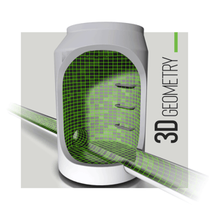
Today, we see this in the buzz surrounding artificial intelligence and its potential role in sewer inspections: automatically identifying defects and coding accordingly before a human operator gets involved. And we see this in a shift toward 3D data as an integral part of inspection workflows. When 3D data is acquired, it offers additional insight into sewers.
This data can be used to further characterize defects, and also to build a virtual model of a collection system. A virtual model can benefit engineers in a number of ways, including helping them model flow capacity, better understand operational risks, work more proactively to predict failures, perform what-if analyses, and optimize overall operations. A virtual model can also be used for augmented reality, giving site workers a virtual glimpse at infrastructure underground in order to plan work. There are a variety of methods used for acquiring 3D data in sewers.
Laser Profiling:
A laser probe is attached to a CCTV crawler and casts a ring of laser light onto a pipe’s interior wall. Software extracts the shape of the ring from the crawler video as it advances through the sewer. Assembling these successive cross-sections yields a 3D model of the pipe’s interior surface.
Sonar:
While laser profiling is able to acquire pipe geometry above the waterline, sonar technologies can inspect below it. Using high-frequency, short-range sound, a sonar probe scans wall geometry, identifying offsets, blockages, defects, silt level, and more in fully or semi-surcharged pipes. To capture a full geometric profile in pipes with flow, laser profiling and sonar data are often combined.
Laser Triangulation:
With laser triangulation, 3D measurements can be captured projecting a laser on a surface and then viewing it off-angle with a camera. Both the laser and camera are directed at the same target area. Knowing the angular offset between the laser and camera, depth differences can be calculated. Laser profiling is a form of laser triangulation, but the technology is also used by manhole scanners to capture geometry.
LiDAR:
As with laser triangulation, LiDAR uses laser light to scan 3D space. But instead of relying on geometric calculations, LiDAR uses time-of-flight, wavelength and projection angle to determine the distance and location where a laser point hits an object. Multiply this over millions of points and you end up with a cloud of points that can be stitched together into a geometric mesh. In pipe and manhole inspections, LiDAR can create a continuous 3-D model. The ovality and surface condition of the pipe, joint and positions and offsets, size and location of defects and connections, flow level, and more can be identified from this model. Simple LiDAR rangefinders can also be used for tasks like measuring the depth of a manhole, or the distance to a lateral connection within a mainline.
Photogrammetry:
With photogrammetry, geometry can be determined by comparing a series of images (usually sequential frames of video) collected during an inspection. Dimensional data is extracted from the footage based on how things change from one video frame to the next. Unlike other methods, this process can be applied to existing inspection video for a retrospective analysis.
Geospatial:
Geospatial technology combines Geographic Information System (GIS) and Global Positioning System (GPS) to locate assets in world space. In the wastewater industry, a GPS device is typically used to establish the position of a manhole. This information can be used when creating a comprehensive GIS map of a wastewater system. The location of manholes and the direction of adjoining pipes are used as reference points to position and orient geometry collected from within assets, and thus help stitch together individual asset models into a single, overarching model of a collection system.
XYZ:
An inertial navigation system (INS), also known as an XYZ sensor, is being added to small-diameter inspection equipment to track the camera’s orientation and position in 3D space. These sensors are beneficial for understanding the location of assets--particularly where lateral and drain lines bend, at what angle, and in what direction.
Pulling It All Together
Many of these technologies are effective for capturing 3D data from asset interiors, while others are well suited for establishing the position of those assets in world space or the trajectory of a line. When these technologies are combined, it allows for the creation of an all-purpose virtual model. Virtual models can help with flow studies, rehabilitation and maintenance planning, capacity planning, and what-if modeling. Combining traditional inspection data with 3D data can also enable augmented reality (AR), where asset features and parameters are georeferenced—or placed in real-world 3D space--and then overlaid on live video. AR will allow a field technician with a smartphone or inspection camera to see virtual representations of hidden infrastructure and details about an assets’ composition, condition and history.
Did you know the ROVVER X sewer inspection crawler can be equipped to offer laser profiling capabilities in seconds? Learn more about this laser ring accessory: